Wednesday 31 May 2023

Ancient Aliens and the Ancient Astronaut Theory

Ancient Aliens: The Cosmic Connection to Human Civilization

Since time immemorial, humanity has been mesmerized by the enigmatic riddles woven into the tapestry of our past. Among the many captivating subjects that bewitch our imagination, few rival the allure of ancient aliens. The ancient astronaut theory, a tantalizing hypothesis, posits that our ancestors encountered advanced extraterrestrial beings who bestowed upon them knowledge, technology, and profound influence. In this captivating exploration, we will venture into the intricate web of ancient aliens, traversing the labyrinth of theories on this fascinating subject.

The ancient astronaut theory is a captivating notion that suggests civilizations from other planets or distant galaxies made contact with our ancient forebearers, shaping our development and leaving an indelible mark upon our history. Advocates argue that clues are embedded within ancient texts, religious scriptures, and enigmatic artwork, offering glimpses into these awe-inspiring extraterrestrial encounters. It is believed that our ancestors, in their limited understanding, interpreted these advanced beings as gods or celestial entities, attributing their remarkable abilities to divine powers.

Alien Encounters in Antiquity: Investigating Ancient Astronauts

The influence of ancient aliens upon our ancient civilizations cannot be understated. Some of the most remarkable ancient wonders and architectural marvels have been attributed to their intervention. The pyramids of Egypt, with their precise alignments and awe-inspiring construction techniques, have long been considered evidence of extraterrestrial involvement. Similarly, the perplexing Nazca Lines etched into the Peruvian desert, visible only from the sky, have ignited speculation about their purpose and potential connections to ancient aliens.

Furthermore, artifacts and archaeological discoveries continue to emerge, providing tantalizing hints of ancient astronaut influences. Ancient cave paintings portraying figures with elongated heads, large eyes, and other non-human characteristics are interpreted by some as depictions of extraterrestrial visitors. Meticulously crafted carvings adorning ancient temples and structures display intricate designs and advanced technological elements, further bolstering the notion of extraterrestrial intervention in human history.

Unearthing the Truth: Ancient Aliens and their Impact on History

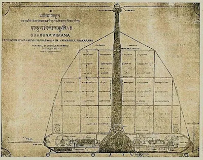
Mythology and religion is filled with tales of gods and celestial beings descending from the heavens. These ancient myths and religious texts, often dismissed as mere fables, bear striking similarities across different cultures. The Anunnaki of Mesopotamian mythology or the Vimanas mentioned in ancient Hindu texts are believed by proponents of the ancient astronaut theory to be accounts of ancient alien encounters, veiled in the language and symbolism of the time.

However, it is essential to acknowledge that the ancient astronaut theory is not without its skeptics and critics. Skeptics argue that the evidence put forth is subjective and open to interpretation. They propose alternative explanations, such as cultural diffusion or human ingenuity, to account for the remarkable achievements of ancient civilizations without invoking extraterrestrial interference.

In recent years, the concept of ancient aliens has pervaded popular culture, captivating audiences through television shows, documentaries, and literature. Programs like "Ancient Aliens" have propelled the subject into the mainstream, presenting alternative theories and unravelling the mysteries of ancient civilizations through the lens of ancient astronauts. This increased media exposure has further ignited public interest, fostering ongoing debates and fervent discussions surrounding the enigmatic realm of ancient aliens.

The Extraterrestrial Enigma: Ancient Aliens and Ancient Astronauts

The realm of ancient aliens and the ancient astronaut theory invites us to embark on a captivating journey of exploration and speculation. While proponents present compelling evidence, skeptics offer alternative explanations, creating a landscape of ongoing debates and fervent discussions. As we delve into the mysteries of our ancient past, it is crucial to maintain an open mind, questioning established narratives and embracing the pursuit of knowledge. Whether ancient aliens are fact or fiction, the allure of this enigmatic subject reminds us of our boundless curiosity and the enduring quest to unravel the secrets that shape our understanding of human history. The exploration of ancient aliens ultimately serves as a reminder of the vastness of the unknown and the endless possibilities that lie beyond the confines of our earthly existence!

Articles you might like:
Sunday 28 May 2023

Possible Underwater City Found in America that's 12,000 Years-Old

In Search of Atlantis: George Gelé's Controversial Discovery off the Louisiana Coast

Beneath the waters near the uninhabited Chandeleur Islands, located 50 miles east of New Orleans, a retired architect named George Gelé claims to have discovered the remains of a submerged city that dates back 12,000 years. This amateur archaeologist believes that the mysterious granite stones found by local fishermen are actually architectural artifacts from an ancient lost civilization predating the well-known Inca, Maya, and Aztec civilizations of the Americas. Gelé's most astounding assertion is the presence of a pyramid, named "Crescentis," within the granite city, which he believes shares a geographical connection to the Great Pyramid of Giza. While Gelé's claims have been met with skepticism, they have sparked curiosity and debate among experts and locals alike.

Unexplained Granite Stones and Underwater Ruins:

The foundation of Gelé's theory rests on the discovery of strange square rocks made by local fishermen near the Chandeleur Islands. The presence of granite in the area is perplexing since it is not naturally found in Louisiana or Mississippi. Gelé, who has made 44 trips to the site over nearly 50 years, has produced underwater sonar images that he believes reveal discernible ruins of major buildings, including a large pyramid. These findings, covered in sand and silt, fuel Gelé's conviction that an ancient city lies submerged off the coast.

From Granite Stones to Submerged Ruins: The Intriguing Tale of Chandeleur's Underwater City
Where did the granite come from? Credit: WWLTV


The Electromagnetic Enigma:

Gelé's claims gain further support from eyewitness accounts, such as that of local shrimper Ricky Robin. Robin recalls his boat's compass spinning uncontrollably near the alleged pyramid's location, suggesting an intense electromagnetic energy emanating from the structure. According to Robin, all electronics on his boat malfunctioned in a manner reminiscent of the Bermuda Triangle phenomenon. These intriguing anecdotes add an element of mystery to Gelé's theory and have fuelled speculation about the origin and purpose of the granite structures.

Beyond Myth and Legend: Investigating the Possibility of an Ancient Underwater City
Are these ruins natural or ma-made? Credit: WWLTV


Alternative Explanations:

While Gelé's theory captures the imagination, many experts remain skeptical and propose alternative explanations for the granite stones and underwater ruins. A late 1980s Texas A&M study suggests that the granite blocks may have originated from old shipwrecks or served as ballast stones discarded by Spanish and French ships to lighten their load when entering shallow waters. Gelé himself presented similar possibilities in 2014, exploring the idea that the stone piles could be remnants of construction projects or the result of several shipwrecks. LSU archaeology professor Rob Mann suggests that the granite slabs might have been placed there in the 1940s during an attempt to create an artificial coral reef.

The Quest for Scientific Validation:

While Gelé's theory remains unproven, it has garnered attention and curiosity among researchers. However, to obtain serious scientific backing, Gelé's claims require further exploration. Future dives, advanced sonar technology, and satellite imaging could potentially provide the evidence needed to validate or refute his hypothesis. With over 80% of the ocean still unexplored, recent discoveries of ancient ruins and artefacts by underwater archaeologists demonstrate the potential for more extraordinary findings in the future.

Exploring the Uncharted: The Lost City Hypothesis and George Gelé's Intriguing Findings

George Gelé's assertion of a 12,000-year-old underwater city off the coast of Louisiana has generated excitement and skepticism in equal measure. While Gelé presents intriguing evidence, including the presence of granite stones and underwater sonar images of discernible ruins, alternative explanations propose more conventional origins for these artifacts. The quest for scientific validation continues, and as advancements in technology open up new possibilities for exploration, the mystery surrounding the alleged submerged city near the Chandeleur Islands remains unsolved. As we venture further into the unexplored depths of our oceans, there is always the promise of uncovering ancient civilizations and remarkable artifacts. The underwater world holds countless secrets that have yet to be revealed. Gelé's theory serves as a reminder that our understanding of history is constantly evolving, and there may be undiscovered chapters waiting to be explored.

While Gelé's claims may seem fantastical, it is essential to approach them with a critical lens. Skepticism is a vital part of the scientific process, ensuring that extraordinary claims are subjected to rigorous scrutiny. As experts continue to investigate the origins of the granite stones and underwater ruins, it is crucial to consider alternative explanations proposed by previous studies.

Nevertheless, Gelé's determination and passion for his findings should not be dismissed outright. His relentless pursuit of uncovering a lost civilization serves as a testament to the enduring human curiosity about our past. The allure of an ancient underwater city, complete with a pyramid emitting mysterious energy, captures our imagination and fuels the desire to explore uncharted territories.

The future of underwater exploration holds great promise. Advancements in sonar technology, satellite imaging, and deep-sea diving capabilities provide researchers with unprecedented tools to investigate and document submerged archaeological sites. These advancements may one day provide the conclusive evidence needed to support or debunk Gelé's claims.

Whether Gelé's hypothesis proves to be an accurate interpretation or an elaborate misconception, the pursuit of knowledge and the exploration of our planet's mysteries remain at the forefront of scientific endeavors. The story of the alleged underwater city near the Chandeleur Islands is a reminder that our world continues to hold secrets waiting to be unearthed, and only through dedicated research, open-mindedness, and the relentless pursuit of truth can we hope to unlock the secrets of our past.

Articles you might like:

Wednesday 24 May 2023

Recently Discovered Mayan Civilization Found Hidden in Jungle

Lost Cities Unveiled: Rediscovering the Magnificence of the Ancient Mayan Civilization
Image Credit: Al Argueta / Alamy Stock Photo / Wikimedia

Deep within the impenetrable jungles of Guatemala, a remarkable discovery is sending shockwaves through the archaeological community. In a landscape shrouded in mystery and centuries of overgrowth, an extensive network of Mayan cities has been unveiled, compelling experts to rewrite the pages of history. This astounding revelation unveils a tapestry of over 400 new settlements, each whispering secrets of a civilization long forgotten. The narrative of the Mayans, once thought to be that of wandering hunter-gatherers, is now transformed into a tale of thriving urban centers intricately connected through a ground-breaking system of roads—an ancient precursor to the modern freeway system. This unparalleled find has been hailed as a "game-changer," defying previous notions and transporting us to an era of extraordinary complexity and architectural grandeur. As we stand on the threshold of these resplendent Mayan cities, we are beckoned to embark on a transformative journey that promises to unravel a lost volume of human history and reshape our perception of one of the world's most enigmatic civilizations. Prepare to immerse yourself in the lush wonders of the El Mirador jungle as we venture forth into the heart of ancient Mayan civilization, where every crumbling stone and intricate artefact reveals a profound tale of ingenuity, heritage, and the enduring spirit of human endeavour.

Unearthing a Hidden Legacy:

The archaeological expedition in the El Mirador jungle has revealed a treasure trove of Mayan cities dating back to 1,000 BC. Previously believed to be nomadic hunter-gatherers, the Mayans, it turns out, were masters of urban planning and construction during the Preclassic period. Renowned archaeologist Richard Hansen described the discovery as a game-changer, highlighting the complexity and architectural sophistication of this ancient civilization.

The Mayan Enigma Revealed: Discovering a Vast Network of Lost Cities in Guatemala
Image Credit: Idaho State University/Richard Hansen

A Journey through Dense Wilderness:

Reaching the newly discovered sites was no easy feat. The El Mirador jungle, with its dense vegetation, presented a formidable challenge. The archaeological team had to navigate through treacherous terrain, confronting potential dangers from jaguars and snakes that roamed the area. The expeditions involved arduous 40-mile hikes or helicopter transport. These intrepid researchers defied the odds to unveil the hidden marvels concealed within the rainforest.

Unlocking the Secrets with Lidar Technology:

The ground-breaking research began in 2015, employing cutting-edge lidar technology to penetrate the dense foliage without causing harm to the environment. Lidar scans provided a unique perspective, generating 3D images of the ancient structures and revealing the foundations of the Mayan settlements. These advanced radar techniques allowed archaeologists to explore the hidden remnants of a civilization lost to time.

From the Depths of the Jungle: Exploring the Newly Discovered Mayan Metropolises

Discoveries That Transcend Expectations:

The findings surpassed all expectations, uncovering not only 417 new cities but also an astonishing 110 miles of interconnected "superhighways." Much like modern urban centers, the Mayan sites exhibited evidence of sophisticated hydraulic systems and agricultural infrastructure. The discoveries have provided a glimpse into a thriving civilization that flourished in the heart of the jungle for thousands of years.

Expanding the Known Boundaries:

The lidar technology not only confirmed existing settlements but also unveiled an additional 900 sites that were previously invisible to the naked eye. The application of this innovative technique has expanded our understanding of the extent and scale of the Mayan civilization. Archaeologist Enrique Hernández expressed his excitement about the discoveries, emphasizing the previously unimaginable scope of Mayan settlements that now come to light.

A Testament to Human Ingenuity:

The recent Mayan excavation has revealed a chapter of human history previously unknown. It attests to the incredible ingenuity, architectural mastery, and societal complexity of the ancient Mayan civilization. These findings provide valuable insights into the cultural, technological, and agricultural advancements of the Mayans, inviting us to reassess our understanding of this remarkable civilization.

The Mayan Empire Resurrected: Unveiling the Hidden Cities of Guatemala's Rainforests

The discovery of a vast network of Mayan cities in the Guatemalan jungle has rewritten the narrative of Mayan civilization. The unveiling of over 400 settlements, interconnected by roads, highlights the architectural sophistication and urban planning capabilities of the Mayans. Thanks to lidar technology, archaeologists have gained access to a hidden world, unlocking the secrets of an ancient civilization that thrived in the heart of the rainforest. This remarkable discovery stands as a testament to the enduring legacy and cultural significance of the Mayan civilization, leaving us in awe of their remarkable achievements.

Articles you might like:

Monday 22 May 2023

The Piri Reis Map: Antarctica's Mysterious Prehistoric Past Revealed

Antarctica's Ancient Enigma: Unravelling the Secrets of the Piri Reis Map

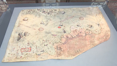
The enigmatic Piri Reis Map has been a source of fascination and debate for scholars, historians, and cartographers alike. Its discovery in 1929 by Gustav Deissmann sparked a journey into the unknown, unveiling a world that defied conventional understanding. As we delve deeper into its intricacies and implications, the map opens doors to a multitude of possibilities, shattering the boundaries of our knowledge and challenging the narratives of our history.

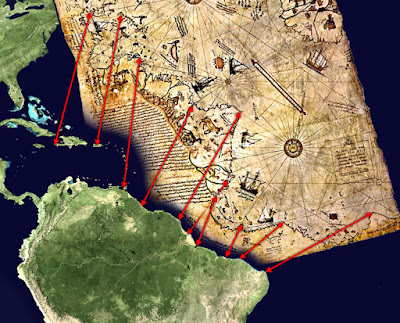
The presence of Antarctica on the Piri Reis Map, a landmass that was not officially discovered until 300 years later, raises profound questions about the origins of this knowledge. How could Piri Reis, drawing on sources from ancient civilizations such as the Greeks and Portuguese, have depicted Antarctica without its icy covering? Was there a lost civilization, existing thousands of years ago, that possessed advanced navigational skills and the ability to chart the globe with remarkable accuracy? The inclusion of Antarctica before its transformation into an icy wilderness hints at the existence of an ancient world far more technologically advanced than previously imagined.

Mapping Antarctica: The Piri Reis Enigma and Lost Civilizations

Moreover, the utilization of the Mercator Projection, a mapping technique not introduced until the late 16th century, adds an additional layer of mystery to the Piri Reis Map. How could Piri Reis have employed a methodology that was ahead of his time? Did he have access to knowledge and resources that have since been lost to history? Or does this point to the influence of extraterrestrial beings who imparted their advanced understanding of cartography to ancient civilizations? The enigmatic origins of the Mercator Projection on the map continue to bewilder researchers, leaving ample room for speculation and intrigue.

While skeptics argue that the landmass depicted on the Piri Reis Map is simply an accurate representation of the South American coastline, the existence of other maps resembling an ice-free Antarctica raises questions about this interpretation. Could it be that Piri Reis was indeed depicting Antarctica, and that our understanding of its history and formation is incomplete? The possibility of a prehistoric civilization that had a profound understanding of the Earth's geography, possessing not only navigational and cartographic skills but also aerial capabilities, leads to tantalizing conjectures. Some even connect these theories to the legendary lost city of Atlantis, envisioning a technologically advanced society that thrived in the depths of antiquity.

Charles Hapgood, with his book "Maps of the Ancient Sea Kings," presented compelling theories about the Piri Reis Map and its implications. His notion of a prehistoric civilization predating 4000 BCE, capable of circumnavigating the globe and accurately charting its lands, challenges conventional timelines and calls into question the trajectory of human development. Although some of Hapgood's hypotheses have been dismissed, his work ignites the imagination and encourages us to explore alternative possibilities in our quest to understand the secrets hidden within the ancient world.

Lost World of Antarctica: Decoding the Piri Reis Map's Clues

As we stand at the crossroads of knowledge and uncertainty, the Piri Reis Map reminds us of the boundless mysteries that lie in wait. It beckons us to cast off the shackles of conventional thinking and embrace the idea that our past may hold wonders and truths beyond our current comprehension. While the true nature and origin of the map remain elusive, its existence alone stirs our curiosity and sparks a thirst for discovery.

The journey to decipher the secrets of the Piri Reis Map is far from over. The pursuit of definitive evidence and a comprehensive understanding continues, as researchers, historians, and enthusiasts delve into the depths of antiquity. With each revelation and each unanswered question, the map invites us to revaluate our perceptions of history, to reconsider the capabilities of ancient civilizations, and to embrace the awe-inspiring notion that our world may have been shaped by forces far more extraordinary than we ever imagined.

In the end, the significance of the Piri Reis Map extends far beyond its enigmatic features. It challenges us to question the limits of human achievement and the depth of our understanding of the past. The map serves as a potent symbol of our ceaseless pursuit of knowledge and the unending quest to unravel the mysteries of our world.

As technology advances and new discoveries emerge, we may eventually find the key to unlock the secrets held within the Piri Reis Map. It is a testament to the resilience of human curiosity and the indomitable spirit of exploration. The map reminds us that history is not a static entity but a living, evolving narrative waiting to be discovered and rewritten.

Antarctica's Forgotten Legacy: The Piri Reis Map and Ancient Civilizations

Whether the Piri Reis Map depicts an ancient advanced civilization, an otherworldly influence, or a mere coincidence of cartographic representation, its allure remains undiminished. It urges us to embrace the unknown, to challenge established paradigms, and to acknowledge that there is still much we do not comprehend about our own past.

The journey to understand the Piri Reis Map is an ongoing voyage of discovery, where each revelation is a stepping stone toward a greater understanding of our shared human heritage. It encourages collaboration and interdisciplinary exploration, as researchers from various fields come together to unravel the mysteries concealed within its intricate lines and symbols.

Ultimately, the Piri Reis Map invites us to contemplate the vastness of our world and the rich tapestry of civilizations that have shaped it. It reminds us that history is not confined to textbooks and archives but is a living, breathing entity that constantly surprises and challenges us.

So let us embark on this intellectual odyssey, driven by a thirst for knowledge and a reverence for the wonders of the past. Let us delve into the depths of antiquity, guided by the enigmatic Piri Reis Map, and embrace the notion that our world is far more extraordinary than we ever imagined.

Articles you might like:

Thursday 18 May 2023

Machu Picchu: Lost City of the Incas

Machu Picchu: Unveiling the Mysteries of an Ancient Wonder

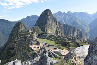
Machu Picchu, nestled high in the Andes Mountains of Peru, stands as a testament to the ingenuity and architectural brilliance of ancient civilizations. This majestic site, hidden among the clouds, has captivated explorers, historians, and travellers for centuries. In this article, we will delve into the rich history and enduring allure of Machu Picchu, exploring its construction, purpose, and significance as one of the world's most fascinating ancient wonders.

Discovering Machu Picchu

Machu Picchu remained a secret to the world until 1911 when Hiram Bingham, an American explorer, stumbled upon its mysterious ruins. Cloaked in mist and encircled by breath-taking mountain peaks, the citadel revealed itself as an extraordinary archaeological marvel. Scholars believe that Machu Picchu was constructed by the Inca civilization around the 15th century, during the height of their empire.

Machu Picchu: Journey to the Enigmatic Heights of Ancient Civilization

Engineering Marvel

One of the remarkable aspects of Machu Picchu is its ingenious engineering. The site is perched on a ridge between two mountains, providing strategic defensive advantages and breath-taking panoramic views. The stone walls, built without mortar, fit together flawlessly, demonstrating the advanced construction techniques employed by the Incas. The precision of their stonework, the intricate terraces, and the sophisticated water management system all speak to their architectural prowess.

Purpose and Function

The purpose of Machu Picchu continues to be a subject of debate among scholars. Some believe it served as a royal estate for the Inca emperor, Pachacuti, while others suggest it had religious and ceremonial significance. Its strategic location and sophisticated design also suggest it may have served as a fortress protecting the Inca Empire. The precise alignment of the buildings with astronomical events hints at its potential role as an astronomical observatory or sacred space dedicated to the worship of celestial bodies.

Machu Picchu: Unravelling the Secrets of an Architectural Marvel

Cultural Significance

Machu Picchu holds immense cultural significance for the indigenous Quechua people of Peru. It symbolizes their rich heritage and serves as a source of national pride. The site's preservation and recognition as a UNESCO World Heritage site have helped promote cultural awareness and tourism in the region, contributing to the local economy and showcasing the remarkable achievements of the Inca civilization.

The Mysteries of Machu Picchu

Despite extensive research and exploration, Machu Picchu still holds many secrets. The precise methods used by the Incas to transport and carve the massive stones remain a mystery. The purpose of certain structures, such as the Temple of the Sun and the Intihuatana Stone, continues to intrigue archaeologists and historians. Ongoing excavations and scientific studies aim to unravel these enigmas and shed light on the ancient traditions and beliefs that shaped this remarkable site.

Machu Picchu: A Window into the World of the Inca Empire

Preservation and Tourism

Preserving the delicate balance between tourism and conservation is a significant challenge for Machu Picchu. The site attracts thousands of visitors each year, highlighting the need for responsible tourism practices to safeguard its integrity. The Peruvian government, in collaboration with international organizations, has implemented measures to protect the site, including limited visitor numbers and strict regulations on construction and maintenance.

Machu Picchu: Discovering the Hidden Treasures of the Andes

Lost City of the Incas

Machu Picchu stands as an enduring testament to the extraordinary achievements of the Inca civilization and continues to captivate the world with its enigmatic allure. This ancient wonder, nestled high in the Andes Mountains of Peru, represents the pinnacle of architectural brilliance and engineering ingenuity. From its precise stone masonry to its intricate terraces and sophisticated water management system, Machu Picchu showcases the advanced skills and knowledge of the Incas.

The purpose of Machu Picchu remains a subject of intrigue and speculation. Whether it served as a royal estate, a religious sanctuary, a fortified fortress, or an astronomical observatory, the site's profound cultural significance cannot be denied. It symbolizes the rich heritage of the indigenous Quechua people and acts as a source of national pride for Peru.

While Machu Picchu has revealed many of its secrets through archaeological research, numerous mysteries still surround the site. The techniques used by the Incas to transport and carve the massive stones remain a marvel, and the significance of certain structures and features continues to puzzle experts. Ongoing exploration and scientific studies aim to shed light on these enigmas, deepening our understanding of the ancient traditions and beliefs that shaped Machu Picchu.

Machu Picchu: A Symbol of Wonder and Cultural Heritage

Preservation and responsible tourism are crucial for safeguarding the integrity of Machu Picchu. Balancing the influx of visitors with the need to conserve the site's delicate ecosystem and architectural wonders poses a significant challenge. The Peruvian government, in collaboration with international organizations, has taken measures to limit visitor numbers, regulate construction activities, and ensure sustainable tourism practices.

As we continue to unravel the mysteries of Machu Picchu and protect its fragile legacy, this ancient wonder stands as a testament to the enduring power of human ingenuity and the remarkable achievements of ancient civilizations. It invites us to marvel at the heights that humanity can reach and serves as a reminder of the rich cultural heritage that must be cherished and preserved for future generations. Machu Picchu remains a symbol of awe-inspiring beauty, a gateway to the past, and a beacon of wonder for all who visit this remarkable archaeological treasure.

Articles you might like:

Tuesday 16 May 2023

Yangshan Quarry: A Puzzling Enigma of Ancient Chinese Engineering

Yangshan Quarry: Unveiling the Enigmatic Ruins of Ancient China
Credit @Vivian May

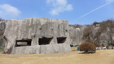
Nestled alongside the Yanmen Shan mountain, approximately 20 kilometres east of Nanjing, China, lies the mysterious Yangshan quarry. While its origins date back to the Six Dynasties period (220 - 589 AD), the majority of the work at Yangshan is associated with the construction boom that followed the founding of the Ming dynasty in 1368 AD. Legend has it that an ambitious project to create an enormous stele for the Ming Xiaoling mausoleum led to a monumental failure. However, upon closer examination, the Yangshan site is an enigma of ancient Chinese engineering and reveals intriguing features that challenge the conventional notion of it being a simple quarry.

The Gigantic Stele and a Costly Mistake:

The tale goes that stonemasons at Yangshan initially attempted to craft three colossal blocks for a stele dedicated to the Emperor. However, they soon realized their miscalculation as the blocks turned out to be excessively large. The actual stele stands at 6.7 meters (22 feet) tall, weighing around 100 tons. In contrast, the mistakenly attempted stele would have been over 73 meters high and weighed a staggering 31,000 tons. The perplexing question arises: How did the master masons embark on such an audacious endeavour?

Unmasking China's Hidden Megalithic Treasures
Credit: @Jasonfu

Questionable Decisions and Curious Carvings:

The story raises doubts about the competence of the masons entrusted with constructing such a grand monument. The variations in size, placement, and shape of the cuts on the stones suggest they were never intended to be placed together. Moreover, the site itself displays peculiar features inconsistent with a typical quarry. Protrusions on the stones, smooth cylindrical segments removed without purpose, and engravings resembling entoptic phenomena hint at an artistic and ritualistic significance rather than mere quarrying activities.

Beyond a Quarry: The Mystery Deepens:

The scale of rock removal at Yangshan surpasses what one would expect from a regular quarry. Millions of tons of rock appear to have been displaced, leaving towering flat walls that defy traditional quarrying practices. The similarities between Yangshan and the enigmatic Longyou caves, located a few hundred miles away, suggest a larger ancient engineering project. The possibility of using rubble-masonry stonework and rammed-earth techniques to shape the site's different parts adds to the enigma surrounding Yangshan's original purpose.

Yangshan's Astonishing Ancient Structures and Engravings
Credit @Vivian May

China's Ancient Ruins and Secrecy:

The secrecy surrounding China's ancient ruins, coupled with the denial of certain megalithic sites, further shrouds Yangshan in mystery. The Chinese government restricts access to many sites, including the most significant and intriguing structures. The existence of numerous pyramids was initially concealed, and some structures were even covered with fast-growing conifers to hide them from aerial surveillance. These actions fuel speculation about a deliberate effort to protect and conceal ancient wonders.

A Lost Legacy of Engineering:

Like other ancient megalithic sites, Yangshan showcases advanced engineering techniques that have long been forgotten. Its builders possessed knowledge and skills that differ from our modern understanding. This disparity in techniques and ideologies highlights a culture that flourished in a vastly different era, leaving behind an enduring puzzle for researchers and enthusiasts to unravel.

A Puzzling Enigma of Ancient Chinese Engineering

The Yangshan quarry, once believed to be a site of failed engineering, reveals itself as a complex enigma that defies easy categorization. The colossal stele and the strange features found within the site challenge the conventional notion of it being a mere quarry. The mysteries surrounding Yangshan, combined with China's secrecy surrounding ancient ruins, create an aura of intrigue and invite further exploration. As we delve deeper into the ancient past, we encounter remnants of a lost legacy, offering glimpses into a different era of human history. Yangshan stands as a testament to the ingenuity and skills of ancient cultures, reminding us that there are still mysteries waiting to be unravelled, and that the past holds secrets that can reshape our understanding of the world.

Articles you might like:

Friday 12 May 2023

Malta's Underwater Cart Ruts and Temples: Unravelling the Mystery

Unveiling the Enigma: Malta's Submerged Cart Ruts and Temples

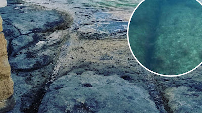
Malta, with its captivating Mediterranean waters and abundant marine life, offers a unique adventure for underwater enthusiasts. Beyond the picturesque scenes, explorers can uncover the enigma of Malta's underwater cart ruts and temples. These parallel grooves, found across the Maltese Islands, raise questions about their origin, purpose, and how they ended up submerged beneath the sea. With over 150 cart rut sites scattered throughout Malta, these ancient tracks continue to intrigue researchers and divers alike.

The cart ruts, distinct parallel grooves, are older than the famous megalithic buildings of Malta. They are found both on land and underwater, suggesting that some of these tracks were engulfed by rising sea levels or geological shifts over time. Some cart ruts mysteriously lead off cliffs, disappearing into the depths of the sea, adding to the intrigue surrounding their purpose and destination.

Lost Secrets of the Mediterranean: The Enigmatic Underwater Cart Ruts and Temples of Malta

Notably, the presence of submerged cart ruts indicates that they predate the speculated timeline provided by archaeologists. The depth at which they lie, up to 40 meters underwater, hints at an age even older than initially believed. The geological history of the region reveals that the sea level was significantly lower during the last ice age, around 10,000 years ago. Additionally, the Mediterranean Sea was completely dry approximately 5 million years ago. However, despite these insights into the changing landscape, the origins and motivations behind the cart ruts remain shrouded in mystery.

Malta and Gozo boast an intricate network of parallel tracks cut into limestone rocks, forming the enigmatic cart ruts. These tracks, resembling paths left by carts, can reach depths of up to 60 cm, with an average distance of 110 to 140 cm between them. Some tracks intersect or branch out, creating a complex pattern that evokes images of a vast railway switching yard. The prevailing belief is that these tracks emerged around 2,000 BC, following the arrival of settlers from Sicily during the Bronze Age.

Scholars have proposed various theories to explain the creation of the cart ruts. One prevalent idea suggests that heavy carts or sledges used for transporting materials, such as stones from quarries or megalithic blocks for temple construction, caused the grooves to form. Over time, the weight of the cargo and the repetitive movement eroded the topsoil, gradually carving tracks into the limestone bedrock. Another hypothesis proposes that the cart ruts served as irrigation channels, distributing water from springs to agricultural terraces. However, the parallel nature of the tracks poses a challenge to the irrigation theory.

Tracing Ancient Footprints: Exploring Malta's Underwater Cart Ruts and Mystical Temple Sites

One particularly intricate and extensive network of cart ruts is located at "Misrah Ghar il-Kbir" near the Dingli Cliffs. Dubbed "Clapham Junction" by an Englishman named David Trump, it resembles a bustling railway station. The cart ruts crisscross the landscape, spanning an area of approximately 8 hectares. Some tracks even lead toward ancient quarries, lending support to the theory that these tracks were created by sleds used to transport rocks.

Unearthing the secrets of Malta's underwater cart ruts and temples unveils a captivating chapter of the island's history. These enigmatic parallel grooves, both on land and submerged beneath the sea, continue to baffle experts and intrigue adventurers. As scholars grapple with theories of their origin and purpose, the allure of these ancient tracks persists, drawing divers and researchers into their mysterious depths. Malta's underwater cart ruts and temples stand as a testament to the island's rich past, inviting us to explore the enigma and marvel at the enduring mysteries that lie beneath the crystal-clear Mediterranean waters.

Articles you might like:
Sunday 7 May 2023

Temple Carved from Single Rock is an Ancient Masterpiece

Kailasa Temple: The World's Largest Monolithic Piece of Art
Credit: @Arian Zwegers

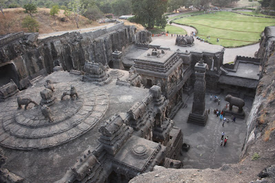
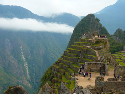
Kailasa Temple is a magnificent piece of ancient Indian architecture located in the state of Maharashtra, India. Built by Hindu craftsmen to honor Lord Shiva, the temple is the largest monolithic piece of art in the world. It was created to mimic Shiva’s home on Mount Kailash in the Himalayas.

According to legend, a Hindu king ordered the temple built after he prayed to Lord Shiva to save his wife from sickness. Architects started carving the structure from the top of the mountain and worked their way down, removing more than 200,000 tons of volcanic rock between 757 and 783 A.D. The carving process took over two decades to complete.

The temple carved from single rock and has a U-shape and is approximately 150 feet deep. The structure is three stories tall and is adorned with large stone carvings of various Hindu deities along the outer walls. Two internal flagstaff pillars depict stories from Lord Shiva’s saga, and there are enormous carvings honoring Lord Vishnu, another main Hindu deity.

Exploring Kailasa Temple: A Wonder of Ancient Indian Architecture
Credit: @Arian Zwegers

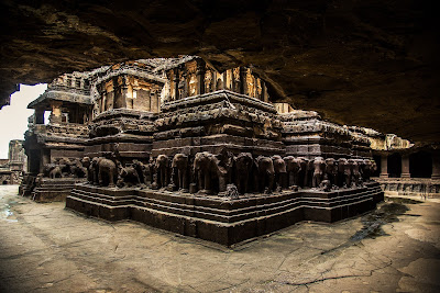
Almost every inch of the interior structure contains intricate carvings. On the top, there are carvings of elephants that point the way down. On the bottom of the main building, an army of huge stone elephants appears to be holding up the entire temple. These elephants surround a 100-foot-tall pillar that serves as the main edifice in the temple complex.

Kailasa Temple covers more square footage than the Parthenon in Athens. The temple is mostly made of black volcanic rock, and it was originally covered in white plaster to give the illusion of snow. Visitors can still see remnants of the white plaster today.

Archaeologists estimate that there are more than 30 million Sanskrit carvings within Kailasa Temple that have yet to be translated. If experts can find a way to unlock the hidden meaning of the language, it would make Kailasa Temple one of the most valuable historical artefacts on Earth.

Despite the temple’s magnificence, there is some controversy surrounding its construction. Some people argue that the Kailasa Temple is much older than believed because there is no way humans in that time period could have excavated such a huge structure. The surrounding caves have carvings that are much older than Kailasa Temple, but this could simply mean that no one got around to carving Kailasa until much later.

From Volcanic Rock to Hindu Shrine: The Story of Kailasa Temple

There are also some theories that ancient aliens may have played a role in the temple’s construction, but that's a whole different story! Regardless of its history, Kailasa Temple is a monument to Lord Shiva, and there are five shrines inside the temple that pay homage to the greatest of Hindu gods. The temple is a marvel to behold and is truly a unique and priceless piece of ancient architecture.

The Kailasa Temple is a remarkable ancient masterpiece that stands as a testament to the ingenuity and skill of ancient Indian craftsmen. Carved from a single rock, the temple has survived for over a millennium and remains a popular destination for visitors from around the world. Its intricate carvings and sculptures, depicting various Hindu deities and mythological stories, are a sight to behold. Despite the controversy surrounding its construction and the mysteries that still surround it, the Kailasa Temple remains an awe-inspiring feat of human engineering and artistic achievement. It serves as a reminder of the rich cultural heritage and legacy of India, and its enduring spiritual significance to millions of people around the world.

Articles you might like:

Wednesday 3 May 2023

Evidence of an Ancient Underwater City in Japan?

Uncovering the Mystery of the Yonaguni Monument: An Ancient Underwater City?

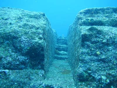
The Yonaguni Monument is an enormous underwater rock formation that covers an area of 60 by 50 meters. It was first discovered in the mid-1980s by a scuba diver looking to observe hammerhead sharks. It is situated off the south coast of Yonaguni, an island in Japan’s southwest corner, about 70 miles from Taiwan and is a popular scuba diving destination. Many people believe it is a monolith carved by man thousands of years ago. Masaaki Kimura, a marine geology and seismology professor at the University of Ryukyus, spent years studying the site and believes it was man-made, suggesting that ancient people once lived where it stands. It’s said to be evidence of the lost continent of Mu, long since submerged following a severe hurricane.

The monument was discovered in 1986 by Kihachiro Aratake, who was diving off the coast of Yonaguni Jima, searching for a new spot to view hammerhead sharks. Accidentally straying outside of the designated safety zone, he found a massive stone structure on the ocean floor at a depth of 35 meters. Despite the heavy encrustation of coral, he explored the monument, taking photographs before returning to shore.

Exploring the Enigma of Yonaguni Monument: Evidence of a Lost Civilization?

Kimura spent over 15 years studying the site, and his observations and data led him to conclude that it was man-made, suggesting that ancient people once lived where it stands. Kimura noted several specific artificial features that supported his theory. These features include marks from tools, a retaining wall, a (suggestive) road, drainage canals, gates, stairways, and two carved monuments shaped like turtles. Kimura also found the suggested remains of tools made from stone and a massive relief carved with animals. Kimura’s evidence initially led him to conclude that the city was over 10,000 years old. Later research led him to fix his estimate to be in the range of 2,000-3,000 years old.

However, skeptics generally dispute any speculation of ancient submerged cities, and the mystery of this site is no exception. Some argue that the straight lines of the formed structure could indicate nature’s natural process of erosion, as sandstones split along horizontal bedding plains that give these regular features. Others suggest that the formation was a foundation for a since-destroyed building or even a quarry for cutting stones. Some skeptics argue that the design and construction would be too complex and challenging for such an ancient people.

The Yonaguni Monument: A Geological Oddity or Evidence of Advanced Ancient Technology?

Evidence of an Ancient Underwater City in Japan?

The Yonaguni Monument remains a subject of fascination and debate among scientists, divers, and enthusiasts alike. While some believe it to be evidence of a lost civilization, others suggest it could be a natural formation or a modified natural structure. Despite years of research and study, there is no clear consensus on its origin or purpose. As such, the mystery of the Yonaguni Monument continues to capture the imagination of people around the world, drawing them to the shores of Yonaguni island to explore its underwater wonders and contemplate the enigma that lies beneath the surface of the sea.

Articles you might like:
Tuesday 2 May 2023

The Incredible Discoveries of India's Forgotten High-Tech Past

Vimanas: Uncovering the Secrets of Ancient Indian Flying Machines

According to a lecture given by C.S.R. Prabhu, senior scientist, NIC, Hyderabad, India had access to advanced warfare technology that was far beyond the capabilities of the West. He argued that the ancient texts Brahmastra and Vimana were early versions of modern nuclear weapons and spacecraft. During the pre-Mahabharata period, there were remarkable technological advancements that were neglected during the medieval period for reasons not yet known. Sastry's texts, dictated in yogic trance, contained technical details on how to assemble, fabricate and erect a spacecraft, and the metals, semiconductors and advanced alloys used, including other minute aeronautical information. Although difficult to believe, the fact that this technology did not exist in the world, not even in America or Europe, during that period makes it hard to disbelieve.

The spacecraft could even become invisible by using a lead alloy called Thamogarbha loha, which would absorb light in a photochemical reaction that would make it disappear. To reinforce his argument, Prabhu mentioned that wall paintings in some forts in Rajasthan depict the use of rockets in Mughal warfare, including by Tipu Sultan of Mysore. The spacecraft's body was made with a metal called Raja Loha, which apart from resisting heat, converted light from lightnings into energy. Prabhu noted that though the texts explained that the spacecraft was propelled by 'Sourasakthi,' modern solar technology does not generate enough power to drag a rocket, but it was a type of nuclear power that was used during that time.

Ancient Indian Vimanas: The Hidden Truth of Flying Technology

The Ararakamra metal was an alloy of copper, zinc, lead, and iron, which is impossible according to modern metallurgy. The Young's modulus of the metal was higher than that of steel, making it stronger. The axle and wheels used Ararakamra material, which allowed the spacecraft to take U-turns and serpentine movements. Prabhu submitted the model and some information on the "super metal" to the Indian Metal Society Conference and claimed that Dr. A. P. J. Abdul Kalam, the advisor to the government on scientific affairs, asked him to bring the design of the plane.

The Indian Institute of Science appointed a committee to investigate the claims but declared Sastry's texts as fraud, possibly due to the descriptions mentioned in the ancient texts being too advanced to believe. Prabhu proposed a project called 'Bharadwaja Institute of Vedic Science' to investigate the so-called 'myths' as scientific formulae on advanced technology. Although this theory is controversial, Prabhu believes in the authenticity of these ancient texts and hopes that future research will help to uncover the truth.

Vimanas: The Incredible Flying Machines of Ancient India

Vimanas: Ancient Indian Flying Machines

The Vedas, some of the oldest Indian texts, describe Vimanas as flying machines with various shapes and sizes. These machines were known for their impressive abilities and were used as weapons of war. The Asvins, the Atlanteans in Indian texts, had more advanced technology than the Indian people, and their "Vailixi" flying machines had a cigar-like shape that allowed them to maneuver both underwater and in outer space.

The ancient guide to Vimanas, Yantra Sarvasva, describes three classes of Vimana based on their range. Some were made to travel locally from one place to another, while others were used to travel to different countries. The third class of Vimanas was used to travel to various planets. Vimanas were non-combustible, unbreakable, and invisible to enemies. They were just as effective on the offensive, able to render enemies into a suspended animation state and cause widespread destruction.

The Enigma of Vimanas: Ancient Indian Flying Technology Unraveled

In the ancient Hindu texts, the empire of Rama existed nearly fifteen thousand years ago during the time of the Atlantean civilization, ruled by Priest-Kings. The empire had seven cities, and the people of the Seven Rishi cities had flying machines named Vimanas. There are four types of Vimanas described in the text, some of which were saucer-shaped, while others were cylinder-shaped. These flying machines had circular aircraft with portholes over two decks and a dome. A Vimana is described as flying with the wind’s speed and producing a melodious sound.

The ancient Indians who created these ships also wrote flying manuals about the controls of several Vimana types. Many of these manuals are still in existence and offer a detailed guide for piloting these craft.

The descriptions of Vimanas in ancient Indian texts and epics provide fascinating insights into the technological advancements of the time. These flying machines were not merely a figment of imagination, but were believed to be real and functional, with detailed instructions on their operation and control. While some may dismiss these accounts as mythical or exaggerated, others believe that they offer evidence of ancient civilizations' technological sophistication. Regardless of one's perspective, the Vimanas' descriptions are a testament to the creativity and imagination of the people of ancient India and offer a glimpse into their culture and beliefs.

Articles you might like: